
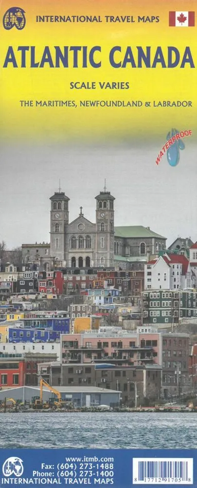
Folded maps of the Atlantic Canada. Side 1 covers Nova Scotia, New Brunswick, and Prince Edward Island as well as QuebecÂs Magdalen Islands at a scale of 1:800,000. This side also includes the Top 10 Attractions of the three provinces. The second side is
Relaterede varer
-
Normandy
kr. 209,95 -
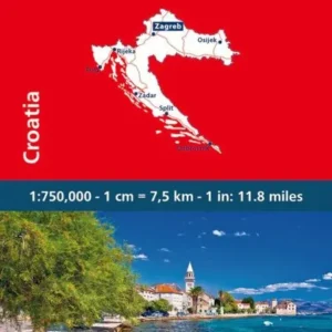
Croatia
kr. 109,95 -
Norwegen Nordkap
kr. 129,95

 Miss Smilla's Feeling for Snow